Driving in Bolivia is utterly terrifying. There are basically no rules that drivers predictably follow. For example, just because you have a green light does not mean it is safe to go. In any event, most intersections have no stop signs or traffic lights. Size matters, a lot, in determining who has the right of way.
And, in the mountains, the roads are unpaved, narrow, a frequently have a sheer drop on one side without any guardrails. Usually there is room for one car with infrequent areas where two cars can pass. Landslides are common, too. No road exemplifies this phenomenon more than El Camino de la Muerte - the Death Road. It sounds a bit melodramatic until you see that, even though more than two thousand memorial crosses have been removed, the remaining crosses are still impressive in number. One estimate has 200-300 deaths per year, including one tragic instance in 1983 when a bus carrying more than 100 passengers plunged about 2,000' to the jungle floor.
Fortunately, a new road was finished in 2006 with support from the IDB, Aimee's employer. The new road is mostly paved and routes almost all motor vehicle traffic to the other side of the valley. The Death Road is a very popular tourist attraction with many companies offering guided descents via mountain bike. Only eighteen cyclist deaths are reported but, like the unreported carnage on Huyana Potosi, the official figures may underreport the actual death toll for PR reasons. In season, hundreds of thrill seekers make the descent per day on full suspension mtbs.
On the other hand, some people just have to be different:
My friend Ariel invited me to ride up the Death Road with him and his bike racing friend Rolando who was visiting from Papua New Guinea. Ariel had finished 6th out of the 170 or so in this year's race up the Death Road which goes from 3,000' near Coroico to 15,200' at La Cumbre. He also won the Tour of Lake Titicaca (now the Tour of Bolivia) a few years ago so he obviously knows a thing or two about pedaling a bike uphill.
We set out from La Paz at 6 am and ran into bad fog crossing La Cumbre. Unfortunately, the bad fog coincided with the closure of one lane of our two lane road. Needless to say, there was no traffic control whatsoever. I have rarely been more frightened than inching down this road into oncoming traffic. The cars and trucks with lights weren't too hard to see and avoid. It was the vehicles without any lights and driving really fast that were the problem.
Anyway, we survived and began our descent toward the Yungas:
The fresh snow and sleet was putting a damper on my enthusiasm but no one brought up going home so I didn't say anything either. The waterfalls were amazing:
After another hour or so, we could see our destination. Coroico:
This is a lower section of the Death Road before it gets so deathy:
Lower slopes of the Cordillera Real:
The cloud forests of the Yungas lived up to their cloudy reputation:
Getting final provisions in Yolosa shortly before blast off:
Cock-a-doodle-doo to you too, bird:
Ariel recommended a 22x28 for the low gear. I chose to ride my cyclocross bike with a minimum 36x28. What could possibly go wrong?
It felt great to ride in the warm, humid, oxygen-rich air at 3,000' after months only riding above 11,000'. I felt like I finally had some power to use.
The vegetation was quite tropical:
An early landslide area:
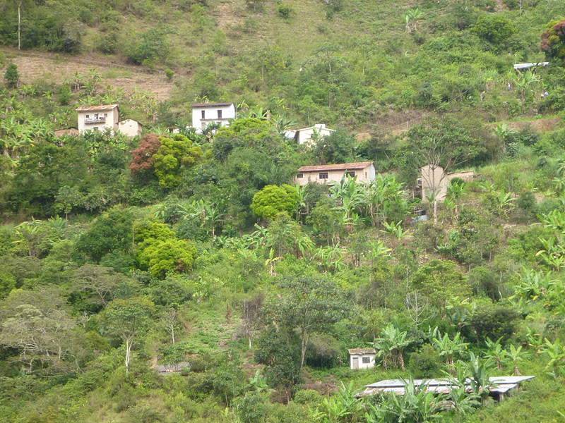
As we got higher, there was less development:
The crosses became more frequent:
One of many, many waterfalls that fell by, on and over the road:
Ariel in one of the bigger waterfalls that mostly fell on the outside of the road:
This is San Pedro Falls:
The grade wasn't too bad in most places but it was pretty relentless:
Rolando:
Still climbing:
Another waterfall nearing the end of the unpaved section:
Only a few kilometers to go from here:
This odd structure marks the end of our ride:
This snakes guards the structure:
The view from the top:
Looking up towards La Cumbre:
The snake's friend or perhaps his lunch:
Still pretty cloudy higher up:
Ariel doesn't look too tired:
More detail from the structure:
We opted out of riding the pavement 35k and 5,000' up to La Cumbre, partly due to fatigue and partly due to crap weather higher up. Personally, I was done after 6,300' of climbing. The smallest gear I had was fine at first, felt great at one hour, and started to hurt at two hours. As we got higher, the elevation began to bite, my legs got fatigued and the road became much more rocky. The last 30 minutes were agonizing but I knew the end was near, one way or the other.
More lovely weather near La Cumbre:
The other day, AnnaMaria, who is learning about Jesus at Collegio St. Andrews, was looking at the bas relief of the Last Supper which graces our dining room, when she declared: "I don't love Jesus but I like his haircut." Jesus watches over Bolivian drivers from La Cumbre.
La Cumbre and the start of the Choro Trek which features some of the best remaining Incan stone trails in Bolivia:
Luckily, the fog had lifted enough to see the road on the way home to La Paz:
Ride fun facts:
Start: 3,500'
Finish: 9,800'
Vertical gain: 6,300'
Time: 3:07
Distance: 17.6 miles